Using Artificial Intelligence to Map Mangroves
Cutting Edge
We are hearing about ‘Artificial Intelligence’ and ‘Machine Learning’ in many aspects of modern life, claimed to be able to dramatically improve our overall standard of living. It was reported recently, for example, that machine learning can outperform doctors in detecting cancer; (https://www.bbc.co.uk/news/health-50857759)
Can such technologies be used in the environmental consultancy sector? The answer is ‘Yes’, and WKC are at the cutting edge of applying machine learning to geospatial and mapping applications.
WKC are at the cutting edge of applying machine learning to geospatial and mapping applications
Machine learning, a type of Artificial Intelligence, uses algorithms and statistical models to perform a specific task, without explicit instructions, instead relying on patterns and inference recognition.
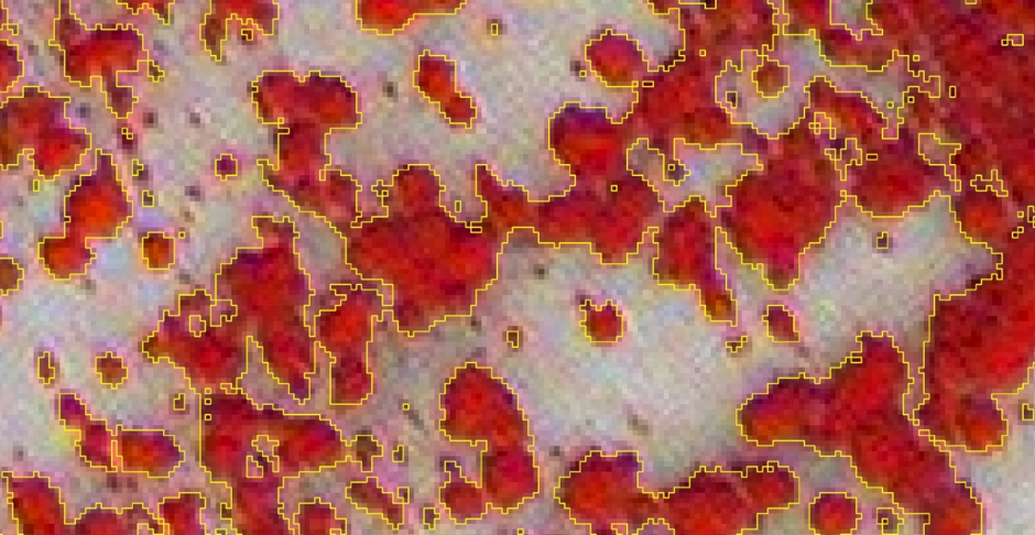
WKC are using machine learning algorithms for satellite image classification. Different ecological habitat types absorb and reflect portions of the electromagnetic spectrum in different ways. By utilising machine algorithms to analyse their spectral properties, it’s possible to map habitats using imagery captured by earth observation satellites in an highly efficient and accurate way.
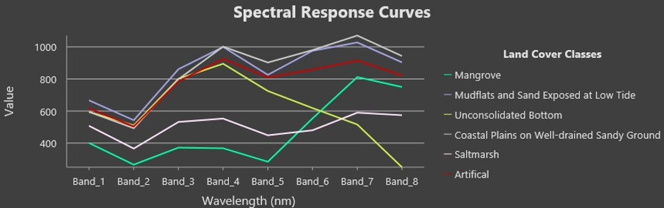
By examining not only the red, green and blue portions of the electromagnetic spectrum but also bands outside of the visible range it’s possible to detect patterns invisible to the human eye.
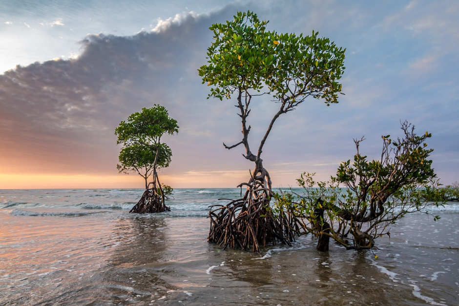
Recognising the Importance of Mangroves Habitats
Mangroves, along with seagrass meadows and saltmarshes are collectively known as “Blue Forests”. They create extremely valuable and productive coastal ecosystems [1], estimated to be worth US$ 33k-57k per hectare, per year to the national economies of countries with these natural resources [2].
Mangroves provide ‘ecosystem services’ to the environment in a variety of ways, including;
- Providing a natural defence against coastal erosion
- Being home to a wide variety of animals and an important breeding/nursery ground for many marine species
- Nutrients and debris from mangroves create nutrient rich waters increases productivity in the surrounding areas
- Improving water quality by acting as a natural filter to pollutants.
- Being important for tourism and recreation
Mangroves are also considered by many to be important in the role of global climate regulation. “Blue Carbon” refers to the ability of coastal and marine vegetation to sequester and store carbon [4]. Mangroves can absorb up to four times more carbon dioxide by area than upland terrestrial forests [5].
Using Machine Learning Technology to Map Mangroves
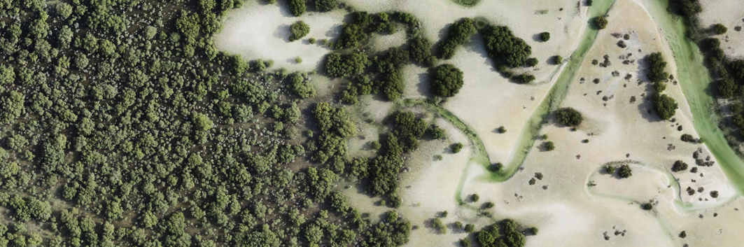
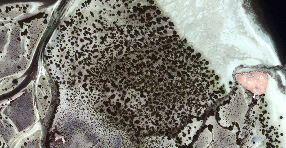
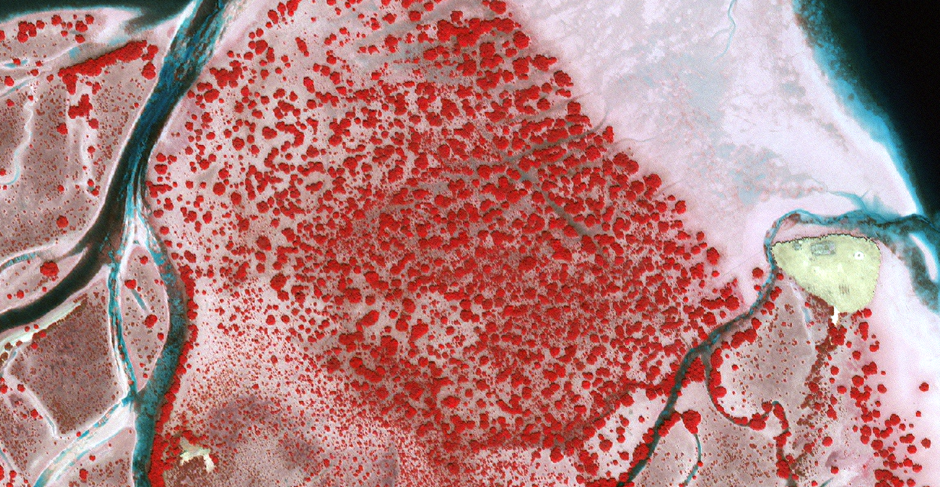
WKC have utilised machine learning technology to accurately map a large area of protected mangroves near Abu Dhabi, UAE. The dataset forms a crucial part of a larger study to monitor and ensure that nearby construction work will not impact upon the mangrove area.
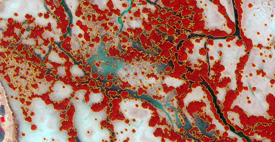
The highly accurate results (Kappa index > 0.9) will be repeated over the next several years to build up a continual picture of mangrove growth in the area.
Mark Brown, head of WKC’s geospatial team based in their London office said,
Innovation underlays everything that we do here at WKC. Our technical expertise and passion for utilising cutting-edge science ensures that we remain at the forefront of advances in the use of space-based and artificial intelligence technologies
Mark Brown
From the use of satellites to drones, global positioning systems (GPS) and rugged field survey tablets, photogrammetry, machine learning and data science, WKC offer a refreshingly modern approach to their environmental consultancy work.
Author: Mark Brown, Senior Consultant – GIS and Remote Sensing
Please contact us to find out more about WKC’s GIS and Remote Sensing capabilities; enquiries@wkcgroup.com
References
[1] Himes-Cornell A, Grose SO and Pendleton L (2018) Mangrove Ecosystem Service Values and Methodological Approaches to Valuation: Where Do We Stand? Front. Mar. Sci. 5:376. doi: 10.3389/fmars.2018.00376
[2] UNEP (2014) The importance of mangroves to people: A call to action. Edited by J. van Bochove, E. Sullivan, and T. Nakamura. Cambridge: United Nations Environment Programme World Conservation Monitoring Centre
[3] Birkhofer K, Diehl E, Andersson J, Ekroos J, Früh-Müller A, Machnikowski F, Mader VL, Nilsson L, Sasaki K, Rundlöf M, Wolters V and Smith HG (2015) Ecosystem services—current challenges and opportunities for ecological research. Front. Ecol. Evol. 2:87. doi: 10.3389/fevo.2014.00087
[4] Abu Dhabi Global Environmental Data Initiative. Blue Carbon in Abu Dhabi – Protecting our Coastal Heritage: The Abu Dhabi Blue Carbon Demonstration Project. (2013).
[5] Donato, D. C., Kauffman, J. B., Murdiyarso, D., Kurnianto, S., Stidham, M. and Kanninen, M. (2011) ‘Mangroves among the most carbon-rich forests in the tropics’, Nature Geoscience, 4(5), pp. 293–297. doi: 10.1038/ngeo1123.