Using Space-Based Technology for Remote Sensing in Libya
Accessing sensitive areas and undertaking field surveys in a country with on-going armed conflict poses obvious challenges. Oil and gas production fields and related processing and transportation facilities are often targeted during conflicts, and so access is basically impossible for all but essential operational staff.
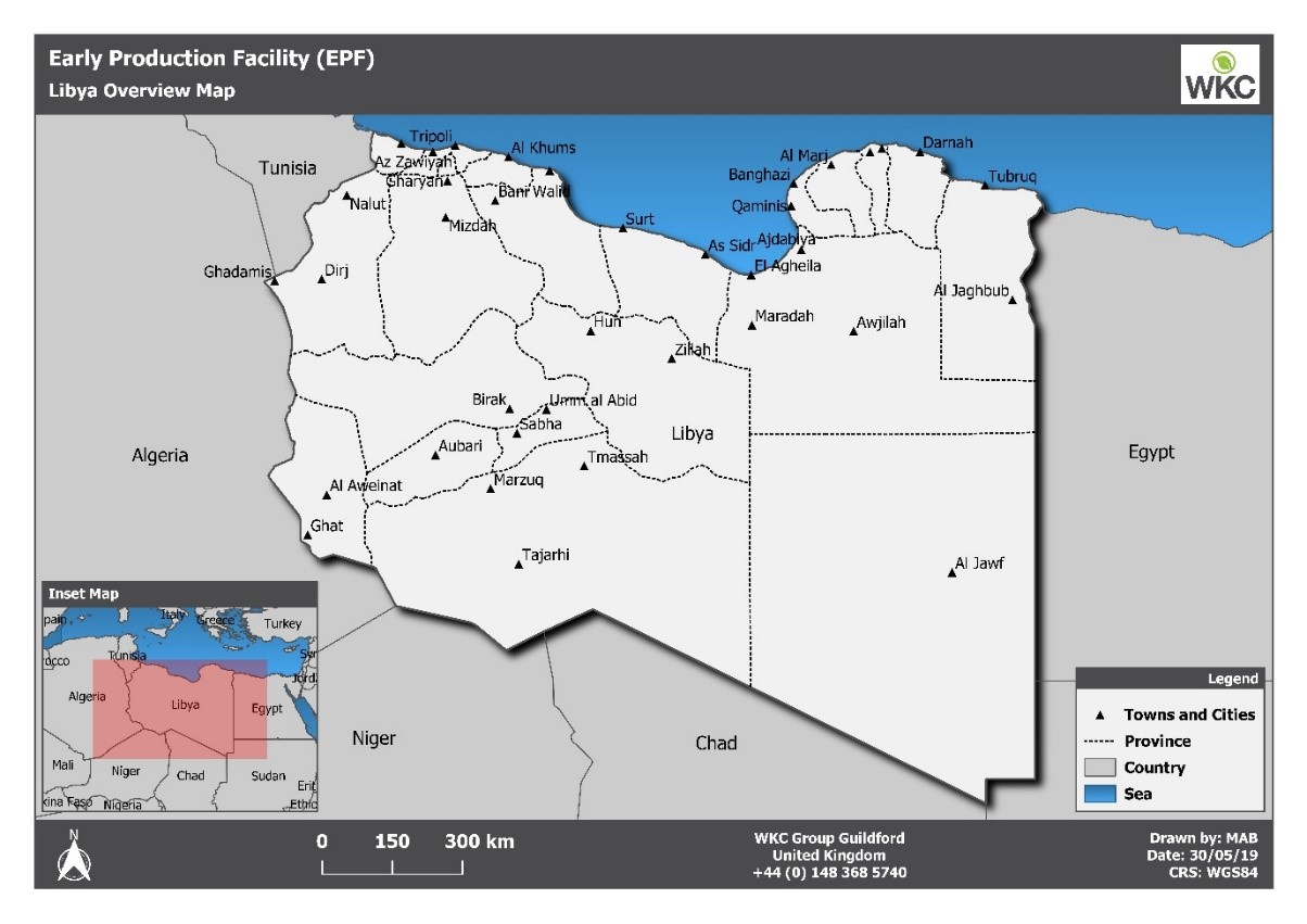
With this as a backdrop, the prospect of carrying out an Environmental Impact Assessment (EIA) for a new early production facility and pipeline in a remote area of the Libyan desert demanded an innovative solution from the WKC specialists.
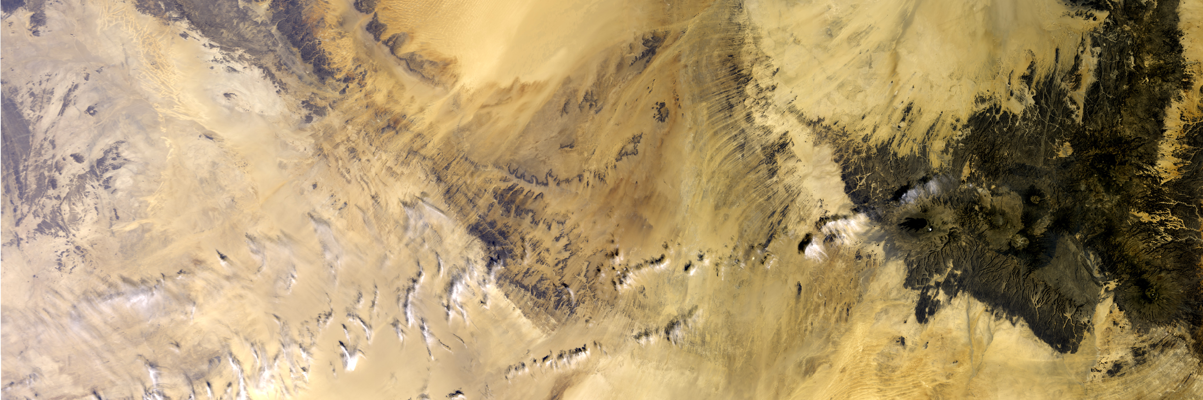
The scope necessitated WKC to determine the type of terrain and habitats that might be impacted during the facility’s construction, commissioning and operation. WKC’s GIS and Remote Sensing team used cutting edge, space-based technology to map the area to a high level of accuracy without the need for the teams to visit the site, as would normally be the preferred method.
Satellite-based remote sensing is a branch of technology that has been around since the 1960’s. Sensors on board satellites orbiting the earth collect information from the earth’s surface. Data can be collected in several ways from the traditional colour imagery, through to use of lasers and radar.
An analysis of the habitats in the area was required in order to make sure that the proposed facility wouldn’t have an impact on any critical or sensitive ecosystems.
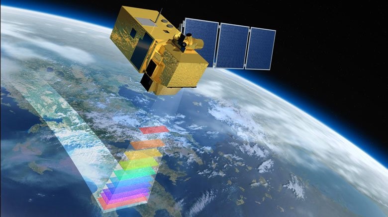
By using multi-spectral data from European Space Agency (ESA) Earth Observations satellites, our GIS and Remote Sensing team worked closely with our ecology specialists to map and quantify the extent of key habitats within the project area.
Earth Observation satellites capture information from varying wavelengths of the electromagnetic spectrum. This include spectral bands such as Red, Blue, Green, Vegetation Red Edge, Near Infra-Red (NIR) and Short Wave Infra-Red (SWIR).
Different land surfaces and vegetation types absorb and reflect light in different ways. By analysing the spectral properties of features on the earth’s surface WKC are able to classify the features into discrete areas and thereby create land cover/land use maps. This is carried out within specialist digital image classification software using the spectral bands captured by Earth Observation satellites.
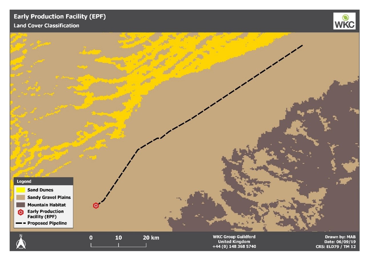
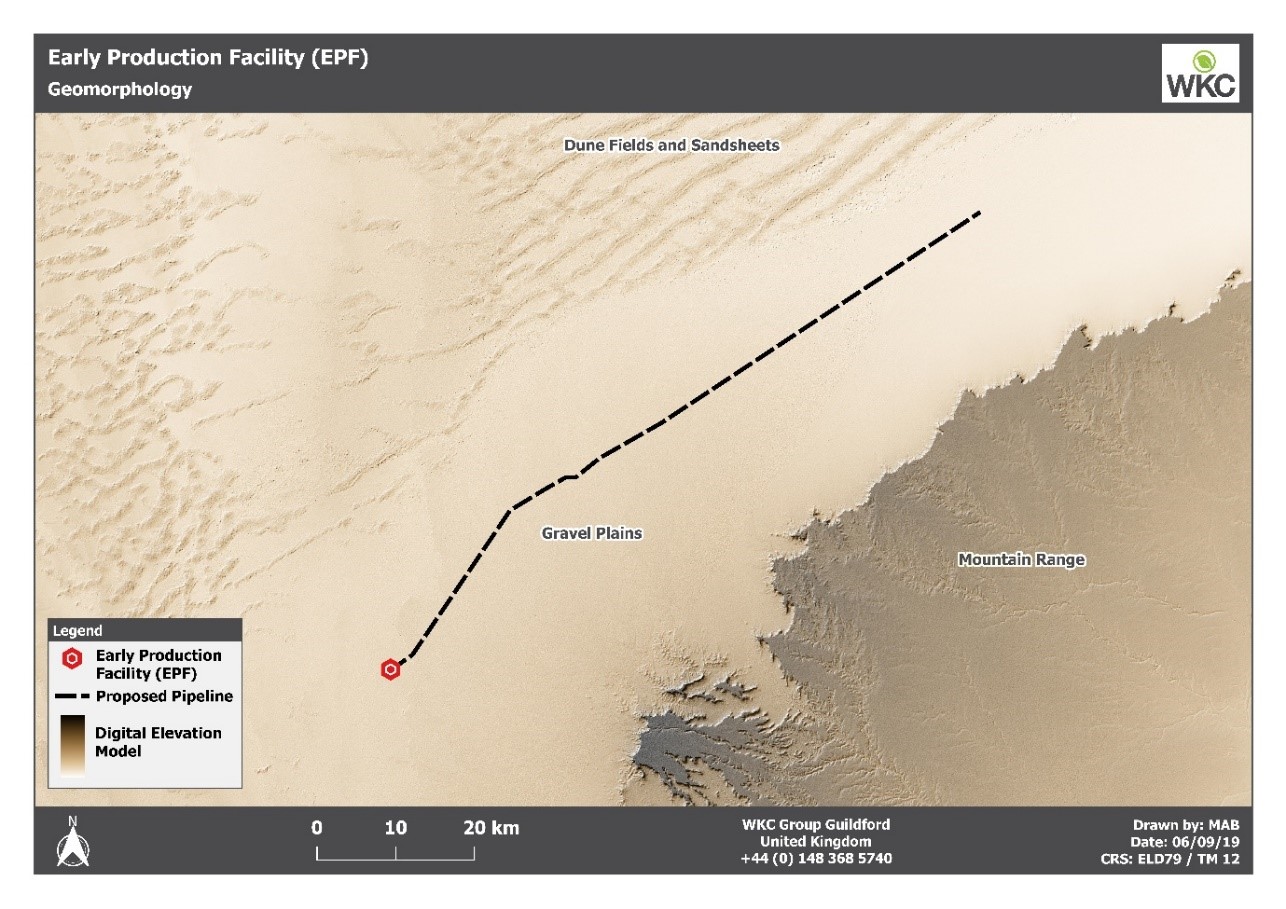
Furthermore, the geomorphology of the area was analysed using data collected by the NASA Space Shuttle, Endeavour. During 2014, an 11-day mission was carried out to capture Earth’s topography at a resolution of 30 meters by employing synthetic aperture radar and interferometry. WKC utilised the NASA data to carry out a topographic analysis along the entire length of a 100km pipeline.
These are just some of the ways that WKC have integrated geospatial technologies into our consultancy work. From the use of satellites to drones, global positioning systems (GPS) and rugged field survey tablets, photogrammetry, machine learning and data science, WKC offer a refreshingly modern approach to their environmental consultancy work.
Author: Mark Brown, Senior Consultant – GIS and Remote Sensing
Please contact us to find out more about WKC’s GIS and Remote Sensing capabilities; enquiries@wkcgroup.com. Also, visit our services page for more information.