The Use of Geospatial Technology in Peatland Habitat Restoration on Windfarm Sites in Scotland – Part 2
By Mark Brown, WKC Group
In the second part of this series, we focus on:
UAV’s – A realm of possibilities
In order to gather valuable information which is used to inform habitat restoration schemes, the use of UAVs is primarily dictated by the need for high resolution elevation data for hydrological modelling purposes within GIS software such as: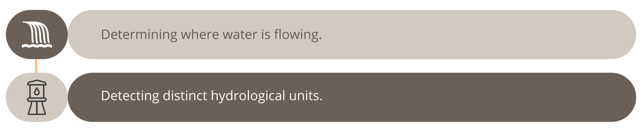
UAVs enable data to be generated at a previous inaccessible scale. Typically, data is processed to around 3.5cm using Pix4Dmapper photogrammetry software.
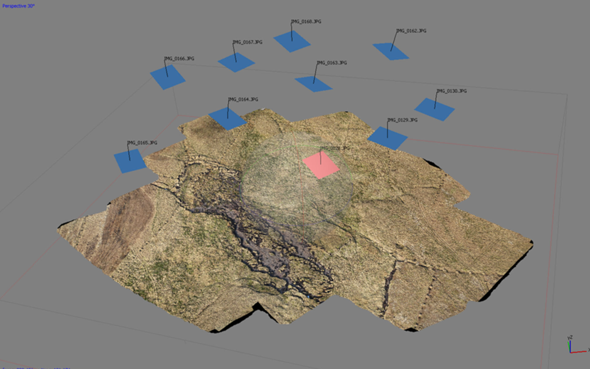
Topographical model of blanket bog processed within photogrammetry software. The blue and pink squares represent the location of the drone when a single image was captured. (Credit: Mark Brown)
The resolution of data captured with UAV technology opens a whole new realm of possibilities for the geospatial analysis of blanket bogs. Areas that are either undergoing or at most risk of erosion can be identified and enable targeting of limited resources.
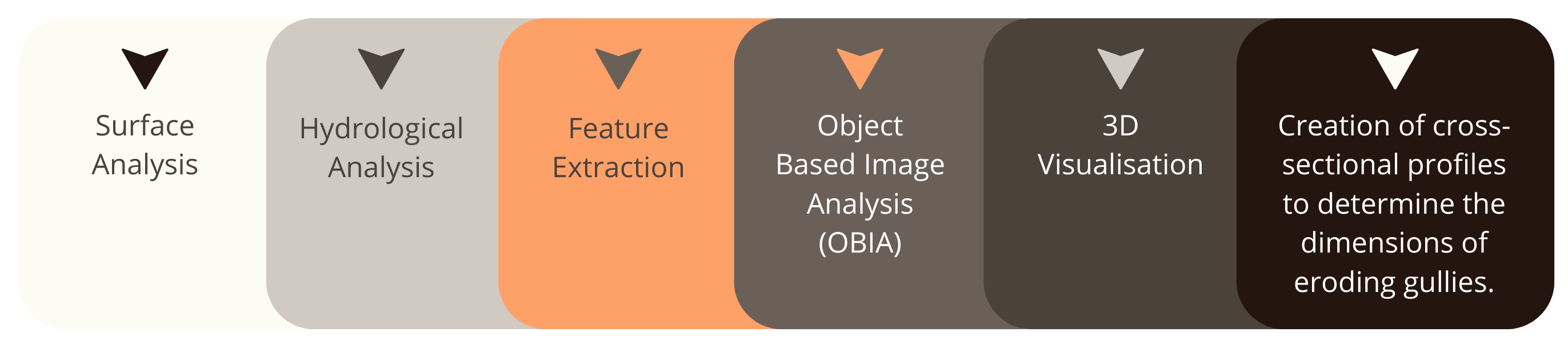
The data generated from UAV flights can be used to carry out a whole range of analyses. Types of analysis include, but are not limited, to:

3D model of an area of degraded blanket bog captured using a Sensefly eBee with Canon WX (18.2 MP) camera. (Credit: Mark Brown)
Cross sectional profiles
It is important for us to know the dimensions of erosion gullies for contractors to calculate the cost to carry out restoration work. Gullies undergo a process of re-profiling whereby the eroding sides are smoothed and levelled to make them suitable for re-vegetation.

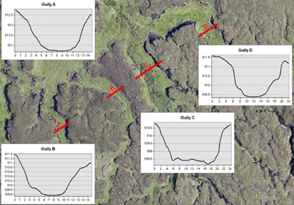
Cross sectional profiles (Credit: Mark Brown)
Surface analysis
There are numerous ways in which a high-resolution Digital Elevation Model (DEM) can be used to analyse the terrain of a blanket bog. By assuming that exaggerated changes signify areas of damage to the bog, a standard deviation filter can be run across the dataset to identify those areas with the greatest variation in topography. By applying a threshold to the resulting dataset, it is possible to accurately extract those areas that are undergoing significant erosion. The data can be used to quantify the total area of erosion and to map where restoration needs to be carried out.
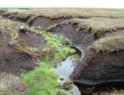
Eroding gullies on a blanket bog with peat clearly visible (Credit: Mark Brown)
Hydrological analysis
A very important area of our peatland restoration work involves blocking grips and gullies to restore the hydrological integrity of peatland. In areas of dendritic gullying, it is not clear, both on the ground and from aerial photographs, to assess in which direction water is flowing. By performing hydrological analysis, it is possible to identify the direction of water flow and therefore map gully systems. Furthermore, identifying sub-basins within watersheds enables targeting of distinct hydrological units.
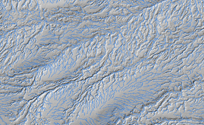
Water flow paths modelled using GIS software (Credit: Mark Brown)
3D Visualisation
By importing the data into 3D modelling software, restoration sites can be examined from every possible angle without the need to return to the field. The blanket bog is literally brought back into the office.
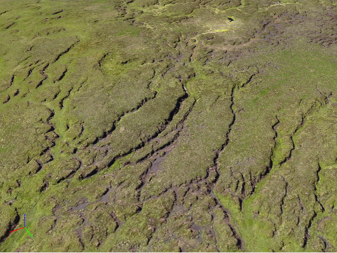
3D Visualisation within Pix4D software (Credit: Mark Brown)
Image classification
By using image classification techniques with aerial imagery captured by a UAV areas of bare exposed peat can be mapped automatically. Work that would have previously taken weeks for a member of staff sat at a computer screen to draw around areas of bare peat can now be performed in a day using the methodologies that have been developed. These areas undergo a treatment of liming, heather brashing, seeding and fertilising. In sensitive areas, the required materials are often carried onto site by helicopter. An expensive exercise, and one where it is important to have an accurate estimate of the quantity of material to be transported in this way.
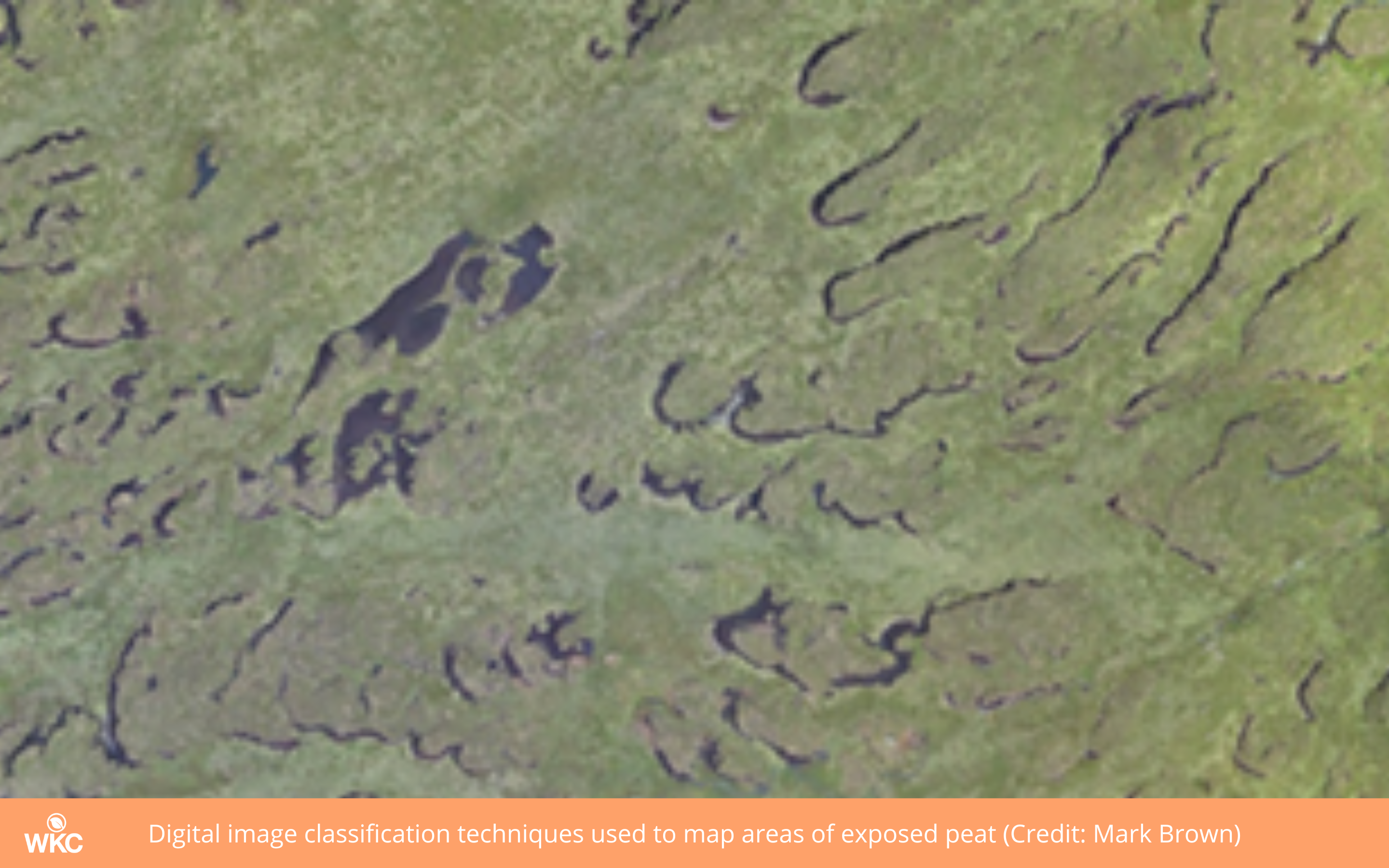
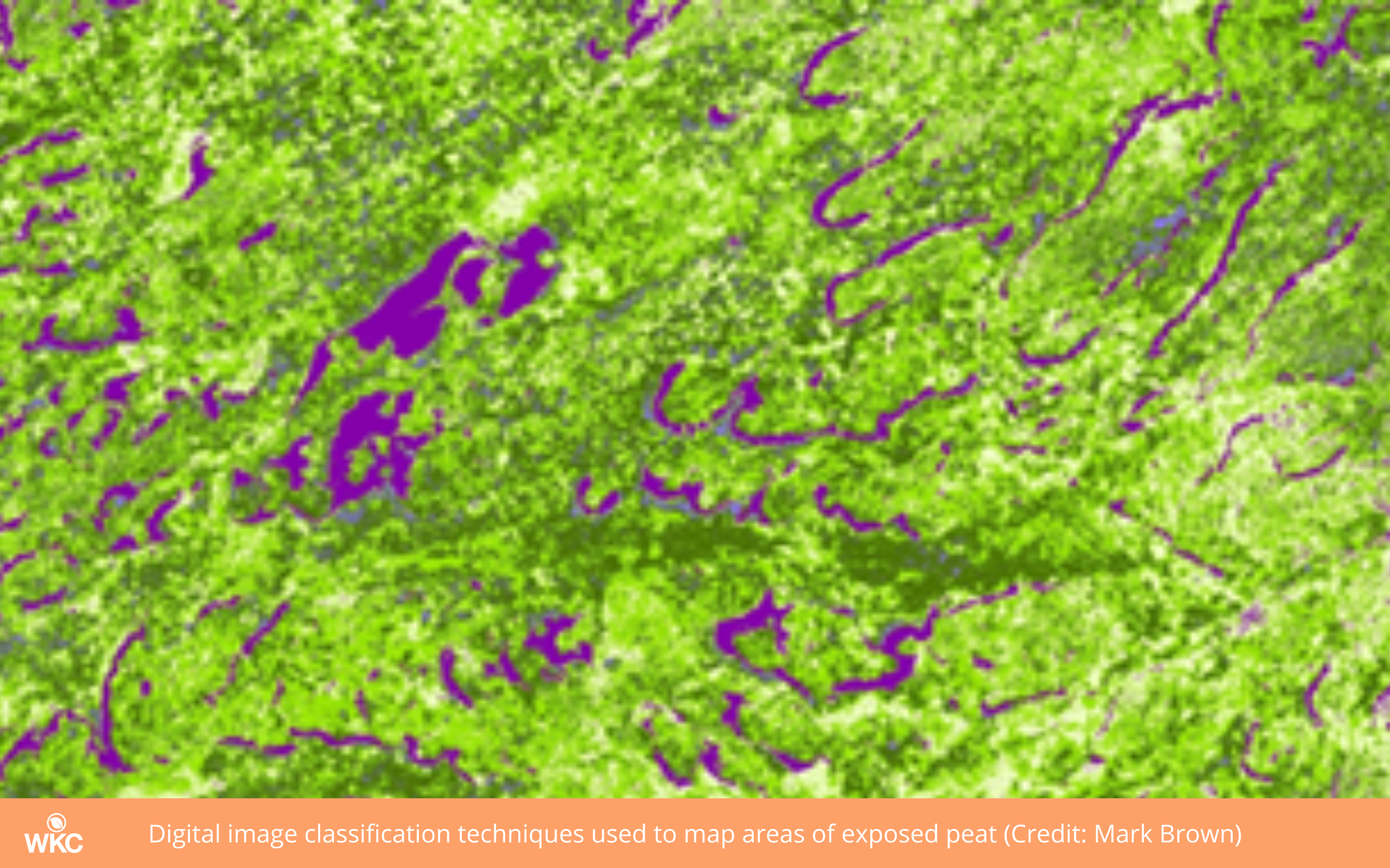
Digital image classification techniques used to map areas of exposed peat (Credit: Mark Brown)
Modelling peat reserves
Field staff collect a wealth of important information when out surveying blanket bogs. Equipped with a sub-meter accuracy Global Positioning System (GPS) mobile field computers, they record plant species such as sphagnum mosses and take measurements to assess the depth of peat.

By using geostatistical techniques such as kriging, the depth of peat can be predicted throughout the blanket bog. By combing the elevation data collected by the UAV with the peat depths collected by surveyors it is possible to produce 3D models of sub-surface peat reserves. The data can be used to calculate the volume of peat beneath the restoration sites and in turn calculate how much carbon is stored there.
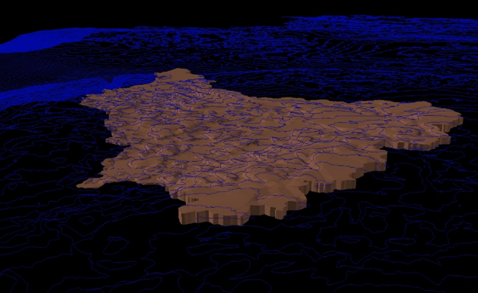
3D Model of subsurface peat reserves (Credit: Mark Brown)
Advantages and Constraints
A bird’s eye view from 400ft above ground level (AGL) (Credit: Mark Brown)
From the use of satellites to drones, GPS and rugged field survey tablets, photogrammetry, machine learning and data science, we offer a refreshingly modern approach to our environmental consultancy work.