How can GIS be used to calculate Biodiversity Net Gain
By Sarah Ramkumar, WKC Group
Biodiversity Net Gain (BNG) is an integral part of developmental planning processes which in practice means that all developments are required to have a positive impact on biodiversity. BNG was introduced as a requirement under the UK Environment Act 2021 which aims to ensure that all development proposals strive to “leave biodiversity in a better state than before”. BNG provides benefits to both people, wildlife, and transforms the way developments are planned, designed, maintained, and built.
The Chartered Institute of Ecology and Environmental Management (CIEEM) has prepared a list of key good practice principles of BNG to ensure that, when followed, BNG and habitat enhancement are achieved.
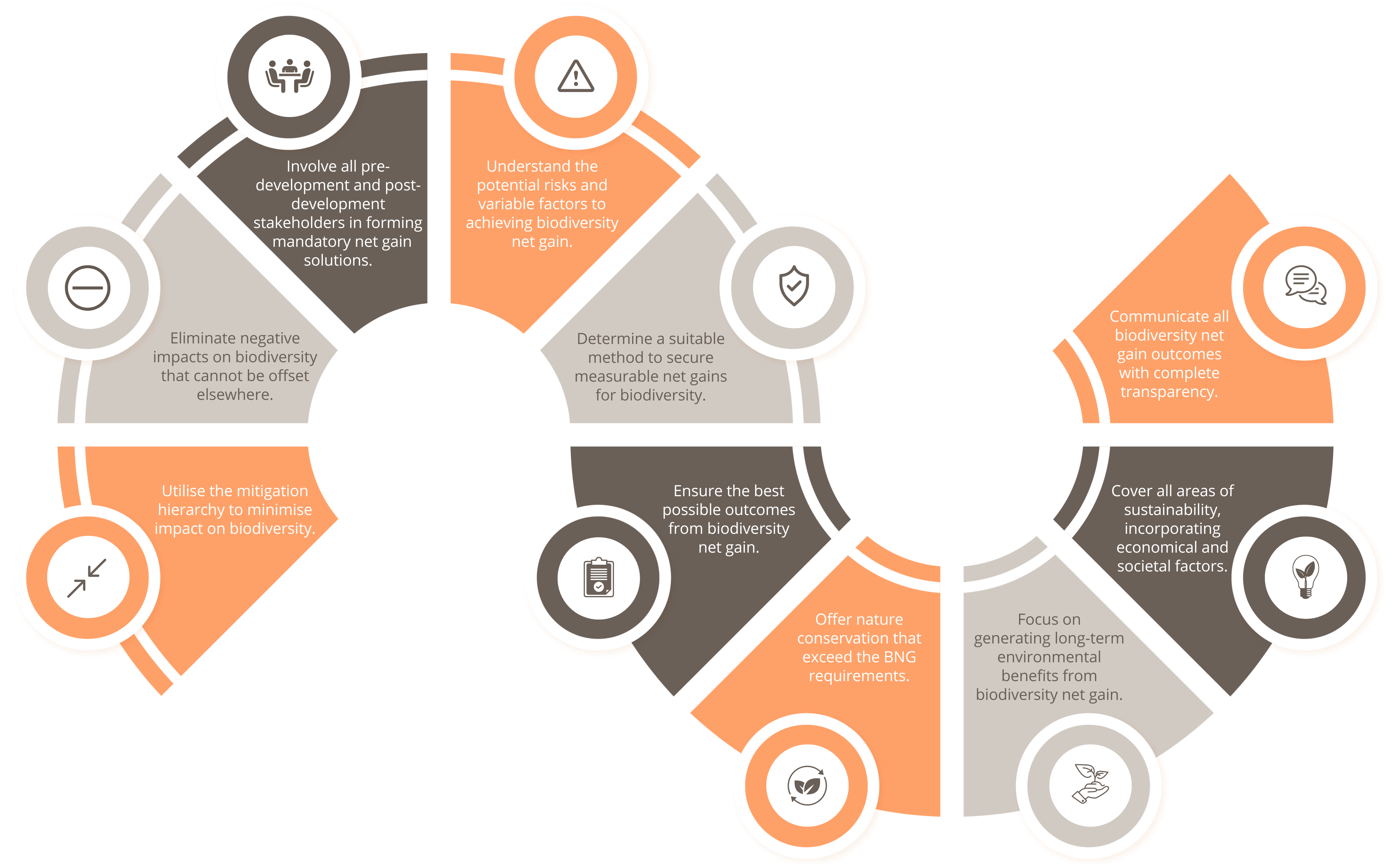
(Click on the image to view in full size)
What does Biodiversity Net Gain mean for developers and landowners?
How to achieve Biodiversity Net Gain?
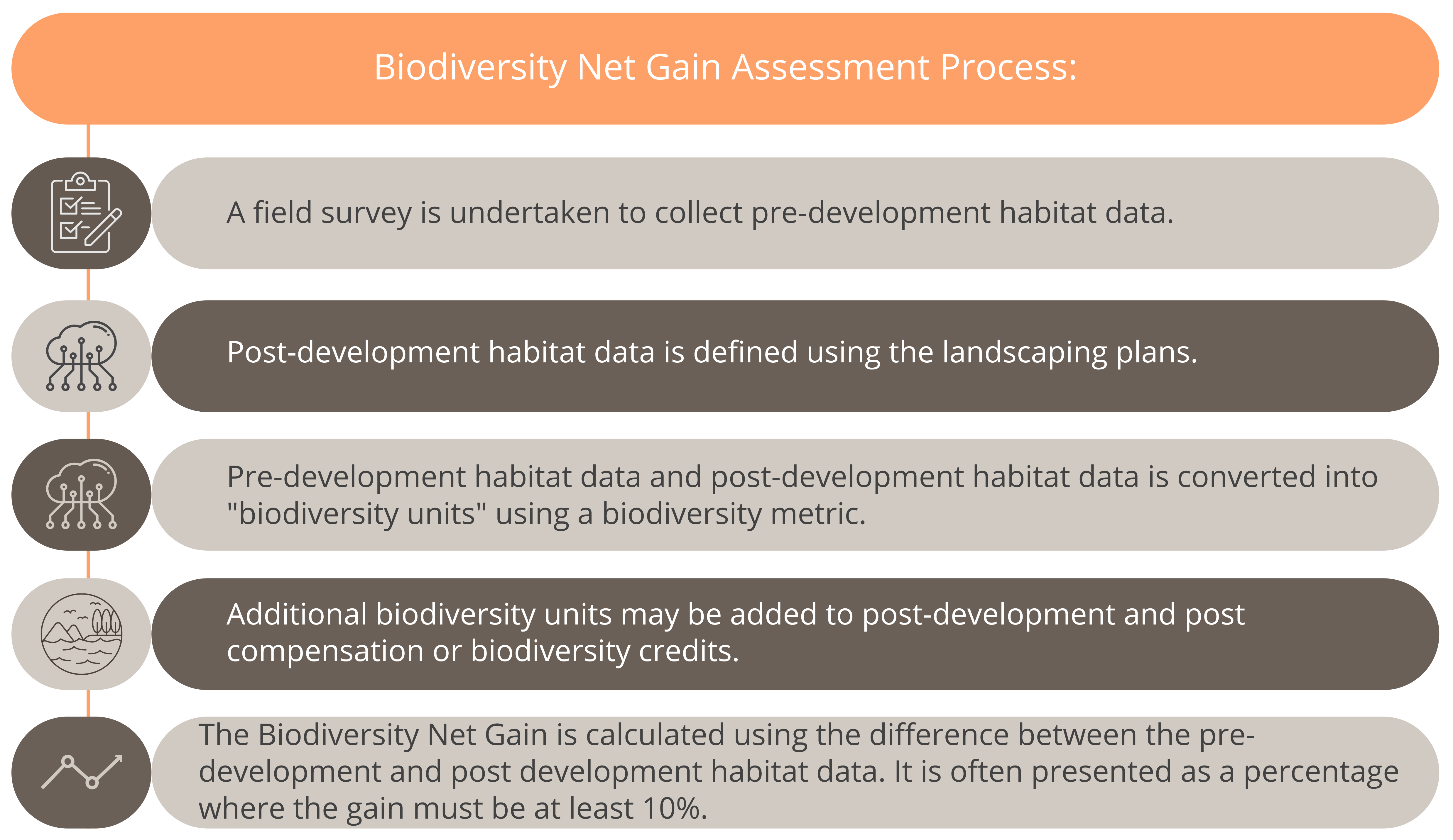
BNG can be achieved on-site, off-site or through a combination of on-site and off-site measures. The capturing of accurate habitat data and maps by Geographic Information Systems (GIS is imperative in this approach.
BNG can be achieved by conducting a Biodiversity Net Gain Assessment which compares baseline conditions to post-development plans. BNG is calculated using the following steps.
What to consider to achieve Biodiversity Net Gain
The intent behind BNG is to put forward efforts which reverse the loss of nature due to developments and preservation. Therefore, developers and landowners must take the below into consideration when preparing a plan for BNG.
What are the requirements for Biodiversity Net Gain?
The National Planning Policy Framework (NPPF) holds local planning authorities accountable to motivate and encourage net gains for biodiversity through planning policies. This then aids the local planning authority to determine how BNG is assessed and enforced within their local jurisdiction, for that specific or all development projects.
From the use of satellites to drones, GPS and rugged field survey tablets, photogrammetry, machine learning, data science, and baseline surveys, our Geospatial Solutions team offers a refreshingly modern approach to our environmental consultancy work.