Visual Impact Assessment for Wind Energy
by Mark Brown
Introduction
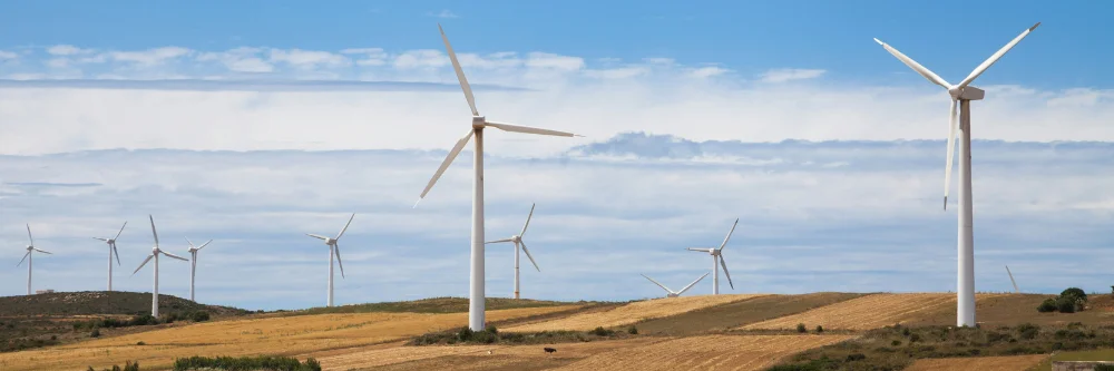
As wind energy expands, understanding its visual and aesthetic impacts becomes crucial. Visual Impact Assessment (VIA) evaluates how wind projects influence landscapes and views, taking into account topography, infrastructure, and public perception.
What is Visual Impact Assessment (VIA)?
One way to assess the impact of a wind energy development on the landscape is through a process known as Visual Impact Assessment (VIA).
VIA is a method used to identify and assess how development affects the landscape and people’s visual experiences and amenity [1].
Regulatory Framework for VIA
The regulatory framework for VIA can vary from country to country. Many countries incorporate VIA as part of their broader Environmental Impact Assessment (EIA) policies.
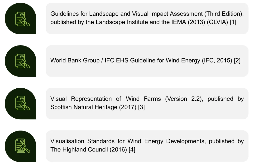
Examples of key regulatory frameworks for wind energy developments include:
Mechanisms for Assessment
Visual impact is not determined by exact formulas or set thresholds, but through an assessment of the sensitivity of visual receptors – such as residents, recreational users, road and rail users – combined with the potential magnitude and significance of changes to their views.
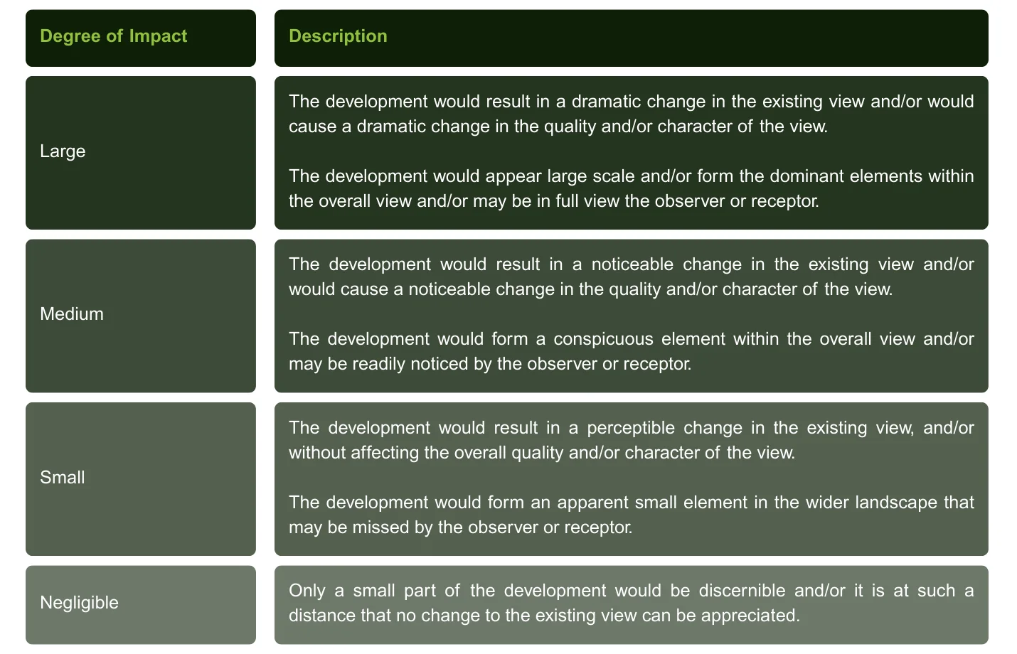
Table: Magnitudes of Impact (Adapted from GLVIA [1])
The digital representation of wind energy developments to support assessment is a key part of the VIA process. Visualisations and digital modelling provide a preview of what the development might look like in the real world or where it might be visible from. To this effect, two key components of the VIA process are the production of photomontages and Zones of Theoretical Visibility (ZTV).
Photomontages
Photomontages are visual simulations that overlay 3D models of wind turbines onto photographs taken from selected viewpoints, using specialist software to ensure accurate scale and perspective. Photomontages help assess potential visual impacts and are shared with stakeholders, the public, and decision-makers.
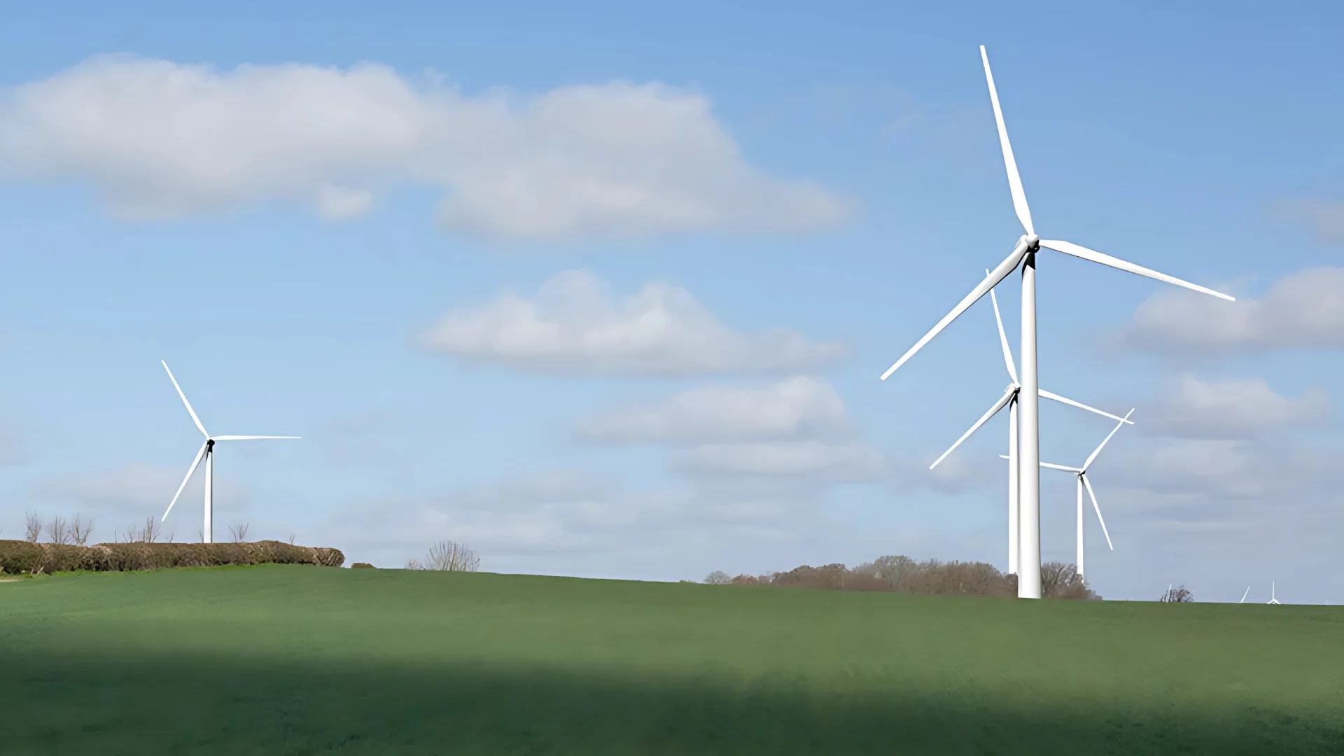
An example of a Photomontage (From Visual Representation of Wind Farms [3])
Zone of Theoretical Visibility (ZTV)
A Zone of Theoretical Visibility (ZTV) is a computer-generated model used to map where a wind energy development is likely to be seen within a landscape. It helps identify areas where the development may or may not be visible based on terrain and turbine height.
Created using digital elevation data and the known dimensions of proposed turbines, the ZTV provides a topographical overview of potential visibility. However, it does not account for visual screening from vegetation or buildings, serving instead as a high-level tool to assess the development’s potential visual impact.
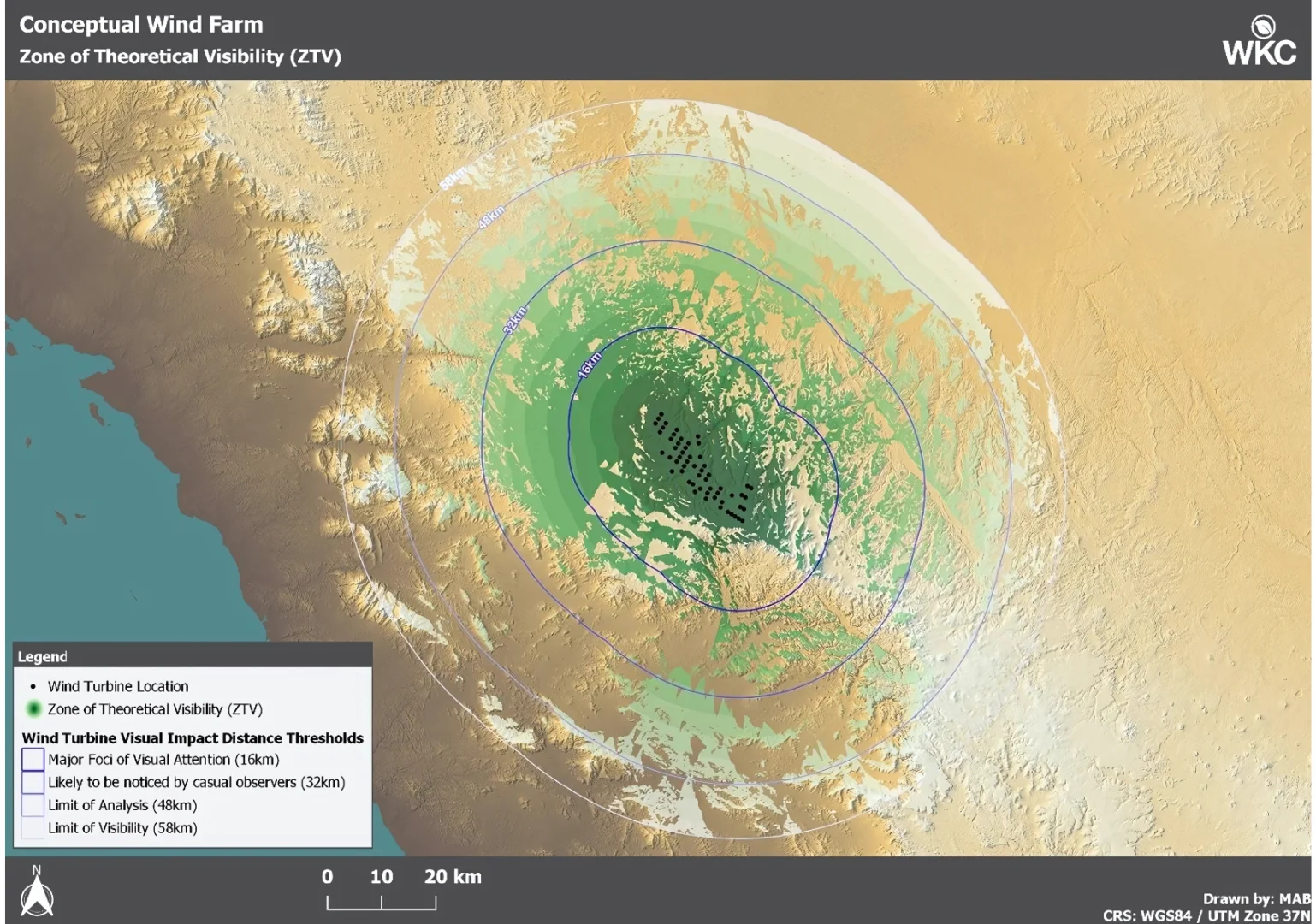
Zone of Theoretical Visibility (ZTV) for a conceptual wind farm in the Middle East. Credit: WKC Group
Conclusion
Visual Impact Assessment (VIA) plays a key role in managing the visual and aesthetic challenges associated with wind energy developments. By using digital tools such as photomontages and Zones of Theoretical Visibility (ZTVs), the process enhances transparency and supports stakeholder engagement by offering both visual simulations and theoretical insights into potential impacts.
As the wind energy sector continues to grow, VIA remains an essential part of responsible project planning—enabling informed decisions that balance the pursuit of sustainable energy with the protection of landscape character and community quality of life.
Contact us to find out more about WKC’s Visual Impact Assessment (VIA) services.
References
[1] Guidelines for Landscape and Visual Impact Assessment, 3rd edition, 2013 (GLVIA)
[2] World Bank Group / IFC EHS Guideline for Wind Energy (IFC, 2015)
[3] Visual Representation of Wind Farms (Version 2.2), published by Scottish Natural Heritage (2017)
[4] Visualisation Standards for Wind Energy Developments, published by The Highland Council (2016)